Alabama Forestry Commission puts essential forestry tools and localized information at your fingertips, helping landowners, professional foresters, and the general public monitor and manage Alabama's forest resources with clarity and purpose. This app consolidates timely fire safety alerts, practical forest management functions, and direct links to official guidance so users can respond faster to changing conditions, plan stewardship actions, and keep property records organized. Designed for people who make decisions about timberland, conservation, or wildfire safety, the Alabama Forestry Commission app focuses on deliverable information and simple controls rather than overwhelming menus.
Key Features
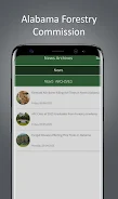
Real-time fire safety alerts are central to the experience, with clear risk indicators and location-aware notifications that help users understand when conditions are elevated. Alerts are written to be actionable, calling out recommended precautions for property owners and land managers, and they display relevant context such as local burn bans and current fire danger ratings when that data is available. When connectivity is present the app receives up-to-date advisories; when offline the most recent alerts remain accessible for review.
Management tools target common tasks that support planning and stewardship without requiring specialized equipment. Users can create and save property profiles, record acres and stand boundaries, maintain a dated log of stewardship activities, and attach photographs to specific parcels or entries. Built-in calculators help estimate acreage, timber volume using simple field measurements, and suggested spacing for replanting. Templates and worksheets guide common decisions like thinning schedules, planting plans, and maintenance checklists so managers can translate field observations into an organized plan.
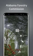
Mapping and visual layers provide an immediate situational picture of your land. Interactive maps combine aerial imagery, parcel outlines, and optional overlays such as historical fire locations and publicly available fuel or hazard layers where applicable. Map controls are optimized for touch devices with intuitive pinch-to-zoom, tap-to-identify features, and a clear legend. Map tiles and user-created property data can be cached for offline viewing so users have critical information in remote locations where cellular coverage is poor.
The app is built around straightforward controls and a compact dashboard that surfaces the most important items first: active alerts, recent property activity, and quick links to official resources and contact information. Navigation emphasizes low friction — one-tap reporting forms, easily adjustable alert thresholds, and simple toggles for which layers and notifications you receive. Settings let you tailor the frequency, geography, and content of alerts to reduce noise while preserving important messages.
Advantages
Alabama Forestry Commission centralizes authoritative forestry information to reduce the time spent searching multiple sites or documents, making it easier to act quickly during periods of elevated risk. For landowners the combination of alerts, mapping, and record-keeping supports better stewardship decisions across seasons. For professional foresters the app provides a lightweight companion that can store field notes, reference safety guidance, and produce simple reports for clients or landowners without forcing them into complex software workflows.
Progression is organic rather than gamified: as users add properties, update activities, and respond to seasonal alerts they build a useful historical record that informs future decisions. That record supports planning cycles such as planting, thinning, and controlled burns by showing previous actions, dates, and photographic evidence, which helps evaluate outcomes and refine techniques. The app’s tools are designed to increase long-term value by making it easy to revisit past entries and measure progress over time.
Accessibility and Offline Use
Accessibility is considered through adjustable text sizes, clear contrast in the interface, and concise wording to make guidance easy to understand for a broad audience. Where system-level screen reader support is available, the app presents content in a straightforward, linear order to facilitate navigation. Offline capabilities include cached maps and saved resources so users working in the field can access their property profiles, images, and the last-known alert information without a live connection.
Limitations and Intended Use
The app is focused on Alabama-specific forestry issues and official guidance, so many features and alerts are state-centered and may not apply outside Alabama. It concentrates on forestry topics rather than broad land-use or non-forestry property management needs, and some advanced measurement or inventory tasks may still require desktop tools or professional software. Real-time alerting depends on connectivity for the most current data, though cached information remains available offline.
Overall, Alabama Forestry Commission delivers a compact set of tools aimed at improving emergency awareness, supporting practical stewardship, and helping users document and plan forest management activities. Its blend of alerts, mapping, record-keeping, and simple calculators creates a useful companion for routine land care and response planning in Alabama’s forests.