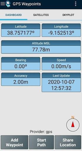
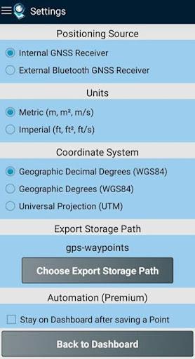
GPS Waypoints is a versatile and powerful tool for mapping and surveying, suitable for both professional and personal use. It is particularly valuable in various land-based surveying activities such as agriculture, forest management, urban planning, and emergencies mapping. It can also be used for personal outdoor activities like hiking, running, and geocaching. The app allows users to collect and classify points of interest, create paths and routes, measure distances, and even determine areas and perimeters. The collected data can be exported to different file formats for further processing. The app supports both internal GPS receivers on mobile devices and external GNSS receivers for higher accuracy. It also offers a premium subscription with advanced features like data backup and analysis. If you need to visualize your data on maps, there is an additional paid functionality called Maps. The app already works with several external receivers, and the developers welcome feedback from users who have successfully tested it with other devices. This app is a must-have tool for anyone involved in mapping, surveying, or outdoor activities.
Features of GPS Waypoints:
- Multi-purpose mapping and surveying tool for professional and personal use.
- Valuable for various land-based surveying activities, including agriculture, forest management, infrastructure maintenance, urban planning, real estate, and emergencies mapping.
- Collects Points and Paths for mapping and surveying activities.
- Points can be classified with specific tags, characterized with photos, and converted into human-readable addresses.
- Paths can be created manually or automatically, and distances can be measured.
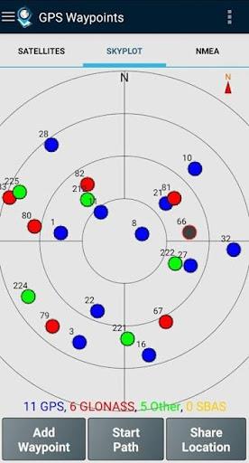
- Allows exporting Points and Paths to various file formats for external processing, and supports external GPS receivers for better accuracy.
Conclusion:
This versatile mapping and surveying app is perfect for professionals and individuals alike. It offers a range of features, including the ability to collect and classify points, create paths, measure distances, and export data for further analysis. With its compatibility with external GPS receivers, users can achieve even greater accuracy. Whether you need it for agriculture, urban planning, hiking, or geocaching, this app is a must-have tool. Download now to experience its full potential.