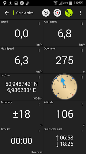
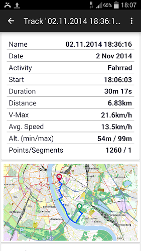
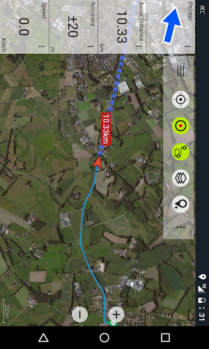
New Zealand Topo Maps is a must-have for anyone exploring the beautiful landscapes of New Zealand, Cook Islands, and Tokelau. With the most recent topographic maps, this app provides you with the same mapping options as a Garmin or Magellan GPS handheld. Whether you're hiking, biking, camping, climbing, or embarking on an offroad 4WD tour, this app has got you covered. Create and edit waypoints, navigate to waypoints, and record tracks with speed, elevation, and accuracy profiles. You can even customize the data fields and share your waypoints, tracks, and routes with others. With various base map layers and overlay layers, you'll have all the information you need at your fingertips. Plus, you can preload map data for areas without cell service. The free version does come with some limitations, but the Pro version offers even more features. These topographic maps, created by Land Information New Zealand, are used by emergency services and a wide range of industries for planning, operational purposes, and recreational use.
Features of New Zealand Topo Maps:
* Easy to use outdoor navigation app
* Provides most recent topographic maps of New Zealand, Cook Islands, and Tokelau
* Offers similar mapping options as Garmin or Magellan GPS handhelds
* Allows users to create and edit waypoints
* Includes GoTo-Waypoint-Navigation and track recording with various data profiles
* Provides customizable data fields, sharing options, and support for different map layers
Conclusion:
This navigation app is a user-friendly and comprehensive tool for outdoor enthusiasts. With its easy-to-use interface and up-to-date topographic maps, it offers a seamless experience. It provides a range of useful features, including creating and editing waypoints, navigation capabilities, track recording with detailed data profiles, and customizable data fields. The app also allows users to share their waypoints, tracks, and routes with others. With extensive map layers and overlay options, it caters to different outdoor activities like hiking, biking, camping, skiing, and more. Additionally, the app offers offline functionality by allowing users to preload map data for areas without cell service. Overall, this app is a must-have for anyone looking to explore and navigate outdoor environments in New Zealand, Cook Islands, and Tokelau.