SW Maps - GIS & Data Collector is a versatile and user-friendly app that allows you to collect, present, and share geographic information. Whether you're conducting a professional survey or simply exploring new areas, this app has everything you need. You can record points, lines, polygons, and even attach photos to create a detailed visual representation. With the ability to connect to external GPS receivers, you can ensure high accuracy in your data collection. Additionally, you can easily share your collected data with others in various formats such as Geopackages, KMZ, or shapefiles. Best of all, this app is completely free and made in Nepal. Spread the word and discover the beauty of Nepal through this amazing app.
Features of SW Maps - GIS & Data Collector:
- Geographic Information Collection: SW Maps - GIS & Data Collector allows users to collect, present, and share geographic information. Whether you're conducting a GNSS survey or simply collecting location-based data, this app has you covered.
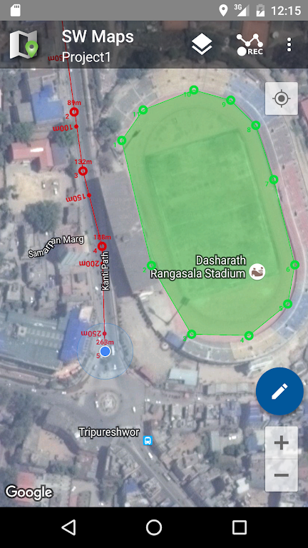
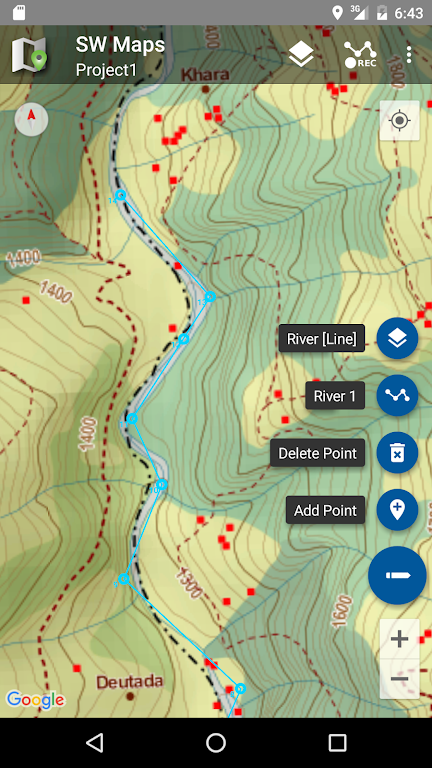
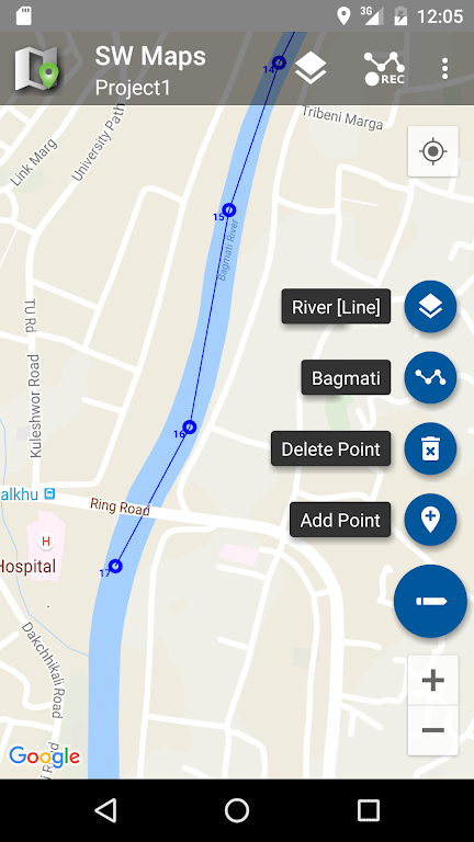
- Various Data Types: Users can record points, lines, polygons, and even photos, which can be displayed on a background map. Custom attribute data can also be attached to any feature, including text, numbers, predefined choices, photos, audio clips, and videos.
- High Accuracy GPS Surveys: The app supports high accuracy GPS surveys using external RTK capable receivers. Users can connect these receivers via Bluetooth or USB Serial and conduct precise surveying. Data from external receivers can also be recorded for post processing.
- Map Editing and Measurement: SW Maps - GIS & Data Collector allows users to draw features on the map by adding markers, measure distance and area, and label features based on attribute values. This feature enables efficient map editing and analysis.
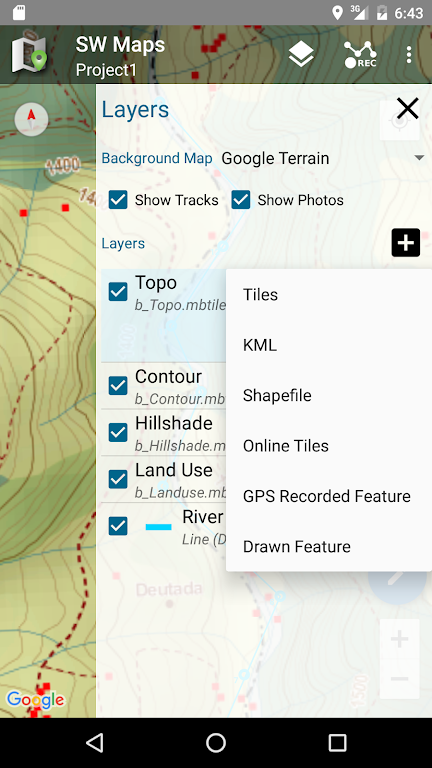
- Data Reusability and Sharing: Users can reuse layers and attributes from previous projects for new surveys or create templates to share with other users. Additionally, collected data can be shared with others as Geopackages, KMZ, or shapefiles, or exported to the device storage in various formats such as Spreadsheets (XLS/ODS) or CSV files.
- Support for Various Map Formats: The app supports a range of map formats, including online base maps like Google Maps and Open Street Map, multiple mbtiles and KML overlays, shapefile layers with attribute categorized styling, and multiple online WMTS, TMS, XYZ, or WMS layers that can be cached for offline use.
Conclusion:
SW Maps is a powerful and user-friendly GIS and mobile mapping app that covers a wide range of functionalities. From collecting and presenting geographic information to conducting high precision GPS surveys, this app caters to the diverse needs of users. With features like map editing, data reusability, and support for multiple map formats, SW Maps provides a comprehensive solution for all your geographic information needs. Download now and experience the ease and versatility of SW Maps for yourself.