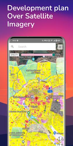
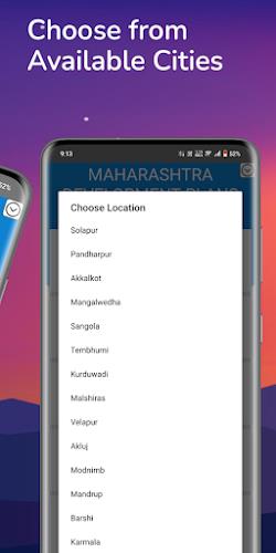
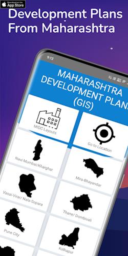
Introducing the Development Plan Maharashtra app, a powerful and user-friendly GIS application that revolutionizes the way you access development plans for cities in Maharashtra. With just a few taps, this app allows you to visualize the future of any area within these cities, providing invaluable information for developers, valuers, and potential buyers. Overlaying the development plans onto satellite imagery gives you a comprehensive view of the area, enabling you to make informed decisions about land development or property purchases. What's more, this app goes beyond standard maps by offering custom maps and village plans, tailoring the information to your specific needs.
Features of Development Plan Maharashtra:
* Development Plans: The app provides access to development plans from various cities in Maharashtra, including Navi Mumbai, Pune, Solapur, Kolhapur, and others. Users can view these plans and gain insights into the future development of these areas.
* Visualization: The app offers an interactive platform where users can overlay the development plans on satellite imagery. This feature allows for a comprehensive view of the area, making it easier to understand the impact of the plans on specific locations.
* Measurement Tools: Users can measure length and area directly on the maps provided by the app. This feature is beneficial for developers, valuers, and potential buyers who need accurate measurements for their projects or property assessments.
* Custom Maps: The app allows users to request custom maps by uploading their own data. Whether it's a specific piece of land, village plans, or other map overlays, this feature provides users with a more detailed view of the area they are interested in.
* Ownership of Custom Maps: Purchased custom maps belong to the users, giving them complete ownership and control over the data. This feature ensures that users can use and access their custom maps whenever they need them.
* Information Verification: While the app sources its information from government websites and documents, it emphasizes the importance of verifying the latest information on the user's end. It also highlights that the app is not affiliated with any government agency, providing a disclaimer to ensure users are aware of the app's limitations.
Conclusion:
The ability to overlay plans on satellite imagery, request custom maps, and use measurement tools makes this app a valuable resource for developers, valuers, and potential buyers. However, users are reminded to verify the information on their end and understand that the app is not a substitute for professional advice. Download Development Plan Maharashtra now to obtain detailed information about specific areas and make informed decisions regarding city development.


